To download full article click link
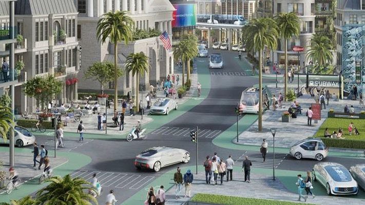
 Autonomous cars controlled by an artificial intelligence are increasingly being integrated in the transport portfolio of cities, with strong repercussions for the design and sustainability of the built environment. This paper sheds light on the urban transition to autonomous transport, in a threefold manner. First, we advance a theoretical framework to understand the diffusion of autonomous cars in cities, on the basis of three interconnected factors: social attitudes, technological innovation and urban politics. Second, we draw upon an in-depth survey conducted in Dublin (1,233 respondents), to provide empirical evidence of (a) the public interest in autonomous cars and the intention to use them once available, (b) the fears and concerns that individuals have regarding autonomous vehicles and (c) how people intend to employ this new form of transport. Third, we use the empirics generated via the survey as a stepping stone to discuss possible urban futures, focusing on the changes in urban design and sustainability that the transition to autonomous transport is likely to trigger. Interpreting the data through the lens of smart and neoliberal urbanism, we picture a complex urban geography characterized by shared and private autonomous vehicles, human drivers and artificial intelligences overlapping and competing for urban spaces.